I don’t usually post about active storms on my website, as I typically use other social media for real-time risk communication. However, the exceptionality of #HurricaneMilton calls for a different kind of analysis that I’d like to share to stimulate discussion among the emergency management community.
In recent days, meteorologists, disaster scientists, emergency managers, and climatologists have highlighted several record-breaking characteristics of Hurricane Milton, including:
– Rapid intensification with a 90 mph increase within 25 hours
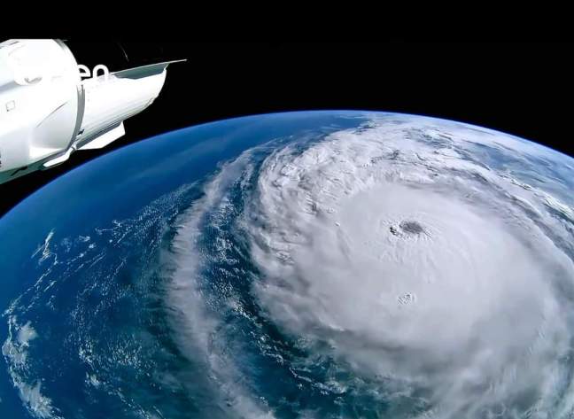
– Tiny eye of 3.8 miles and total eye replacement overnight
– Barometric pressure dropping to 897 mb
– Tornado development over 12 hours before projected landfall
– Maximum sustained winds of 185 mph with gusts over 200 mph
– Catastrophic storm surge up to 15 ft in coastal areas
Together, these characteristics make Hurricane Milton a potentially catastrophic storm, projected to impact Florida’s West Coast tonight (2024.10.09) and into tomorrow (2024.10.10). The low barometric pressure, total eye replacement, and contact with unusually warm Gulf waters have fueled Hurricane Milton, contributing to its size and the amount of rain. Milton’s winds extend up to 125 miles from its center.
Evacuation orders have been issued along the West Coast and parts of Central Florida due to high wind speeds, flooding, and potential tornado formation. Residents on the coast whose landfall is projected on, have been ordered to evacuate, those with special needs, living in mobile homes or low-lying areas have been ordered to evacuate even inland in Central Florida. Inland areas of Central Florida will likely experience lower wind gusts if the path stays or keep shifting south, but since the north side of Milton appears to be the one set to cause potentially massive flooding events, flood risk still remains high in those areas.
As both a disaster scientist and a resident of Central Florida, Hurricane Milton is more than just a storm to analyze—it’s a personal concern. We will stay vigilant and monitor developments over the next 12 hours. After the storm passes, it will be time for the community to come together and support each other. As emergency management community, instead, it will be time to sit down and think through our profession to make our recommendations effective and feasible by being on the ground if and when needed, and when we are not a burden.
Stay safe, Florida.
Sara Belligoni
Featured Image Credits: International Space Station
